
Anyone?CExtDLL::LoadMapFile error
- NULL handle to DLL procedure
CMapGroup::LoadMapFile2 error
- error loading file
CMapGroup::LoadMapFile error
- Call to LoadMapFile2 failed
CExtDLL::LoadMapFile error
- NULL handle to DLL procedure
CMapGroup::LoadMapFile2 error
- error loading file
CMapGroup::LoadMapFile error
- Call to LoadMapFile2 failed
CExtDLL::LoadMapFile error
- NULL handle to DLL procedure
CMapGroup::LoadMapFile2 error
- error loading file
CMapGroup::LoadMapFile error
- Call to LoadMapFile2 failed
L3dt problems
Moderator: Moderators
L3dt problems
Re: L3dt problems
Hi Hoi,
It looks like you've got a dodgy file I/O plugin there.
Can you please send me the logfile? (to aaron@bundysoft.com) You can access it from the start menu under 'All programs->Bundysoft->L3DT [version]->L3DT log file'. With this file, I should be able to work out what has gone wrong.
Best regards,
Aaron.
Re: L3dt problems
Hi Hoi,
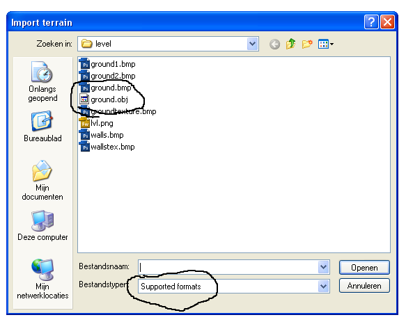
Thanks for the logfile. From the log I can see that you were trying to load an OBJ file in L3DT. However, the OBJ plugin doesn't support loading; it is only for exporting OBJ files. This is the cause of the errors in the log.
L3DT can load heightfields in the following formats:
Aaron.
Thanks for the logfile. From the log I can see that you were trying to load an OBJ file in L3DT. However, the OBJ plugin doesn't support loading; it is only for exporting OBJ files. This is the cause of the errors in the log.
L3DT can load heightfields in the following formats:
- BMP
- JPG
- PNG
- PGM
- PCX
- RAW
- TER (Terragen)
- BT (Virtual Terrain Project)
- HFF/HF2/HFZ (L3DT)
- SMF/SD7 (Spring)
Aaron.
Re: L3dt problems
Then that must be a bug.
Do you know of any way to get a .obj or any other 3d file into a format so that l3dt can load it?
-
Pressure Line

- Posts: 2283
- Joined: 21 May 2007, 02:09
Re: L3dt problems
you do know that Atorpy is the guy who MAKES L3DT dont you Hoi?Hoi wrote:Do you know of any way to get a .obj or any other 3d file into a format so that l3dt can load it?

Re: L3dt problems
Wow, I am very very pleasantly surprised that Aaron actually visits this site and provides help for his product!
Go Aaron, L3DT rocks!
Go Aaron, L3DT rocks!
Re: L3dt problems
Yes, but I mean, tht if l3dt cant load .obj, he might know of some other program which converts 3d files to a format which is readable for l3dt.Pressure Line wrote:you do know that Atorpy is the guy who MAKES L3DT dont you Hoi?Hoi wrote:Do you know of any way to get a .obj or any other 3d file into a format so that l3dt can load it?
-
Forboding Angel

- Evolution RTS Developer
- Posts: 14673
- Joined: 17 Nov 2005, 02:43
Re: L3dt problems
what is the obj of?
l3dt is a terrain generation program... Premise does not compute.
l3dt is a terrain generation program... Premise does not compute.

Re: L3dt problems
blender supposedly could/can/could at some point.

Re: L3dt problems
If you want to convert an .obj into a height map then the easiest method is to just render it. Use an orthogonal projection and apply a linear gradient texture to the landscape which is white at highest point of the landscape and black at the lowest point. Most 3D modeling packages should be capable of this. Blender can probably do it.
And no, it doesn't make sense for L3DT to import an .obj file directly. A height map is 2D but an .obj file contains 3D data.
And no, it doesn't make sense for L3DT to import an .obj file directly. A height map is 2D but an .obj file contains 3D data.
Re: L3dt problems
Hi Hoi,
Cheerio,
Aaron.
Right you are. The next release will only list file formats that support the load operation in the import dialog. Thanks for the bug report.Hoi wrote: Then that must be a bug.
Cheerio,
Aaron.